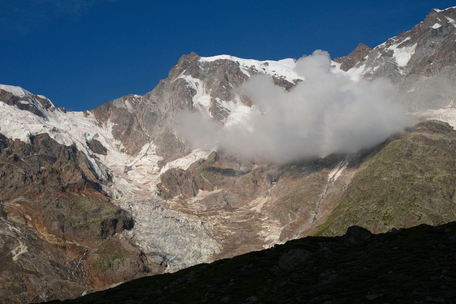
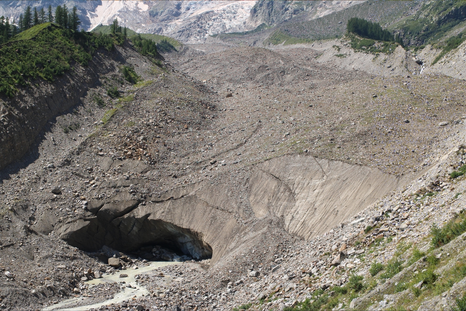
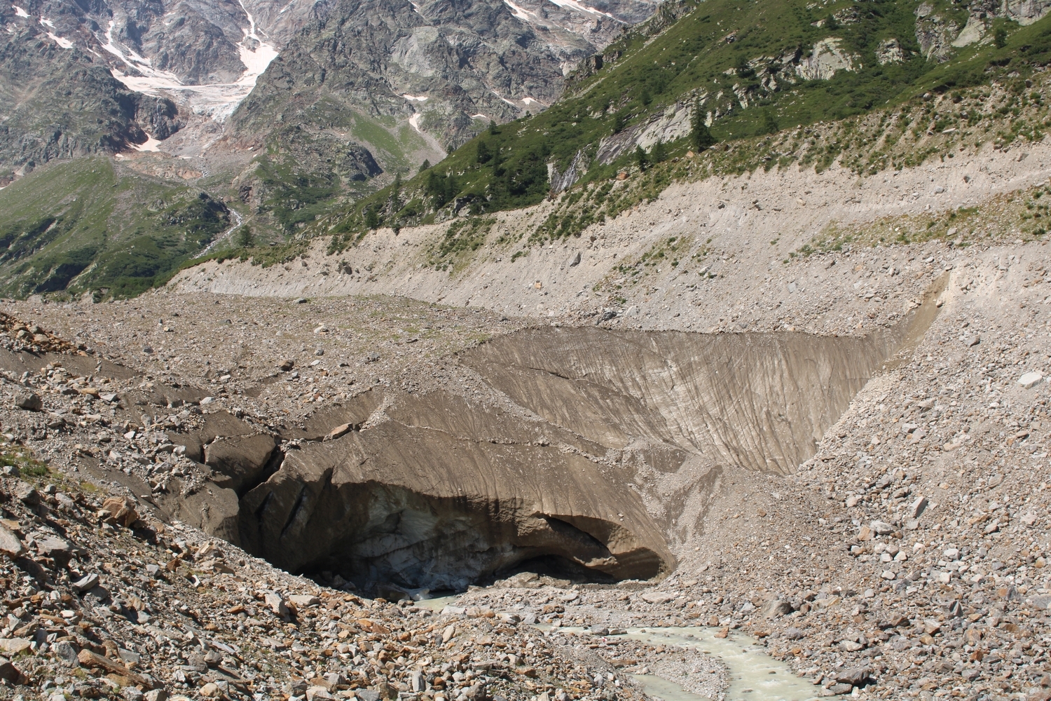
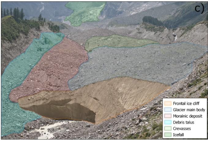
The Belvedere Glacier is a debris-covered glacier located in Valle Anzasca, at the feet of Monte Rosa’s east face (Italian Alps).
The Belvedere Glacier extends from an altitude of about ∼2250 m a.s.l and reaches its lowest altitude at about 1800 m a.s.l., where it splits into two different glacier tongues. it covers an area of ∼1.8 km2, with a length of ∼3000 m and a maximum width of only ∼500 m
Over the last century, the Belvedere Glacier has experienced extraordinary dynamics, such as a surge-like movement or the formation of a supraglacial lake, which seriously threatened the nearby community of Macugnaga.
Explore 3D models of the Belvedere Glacier with Potree
Explore our photogrammetric models of the Belvedere Glacier reconstruction the glacier evolution from 1977 to 2022 (Use a web browser from a desktop/laptop for the best experience).
https://thebelvedereglacier.it/potree
All the points clouds, DSM, and orthophotos are available for download in this Zenodo repository:
https://zenodo.org/doi/10.5281/zenodo.7842347
Long-term photogrammetric monitoring of the Belvedere glacier
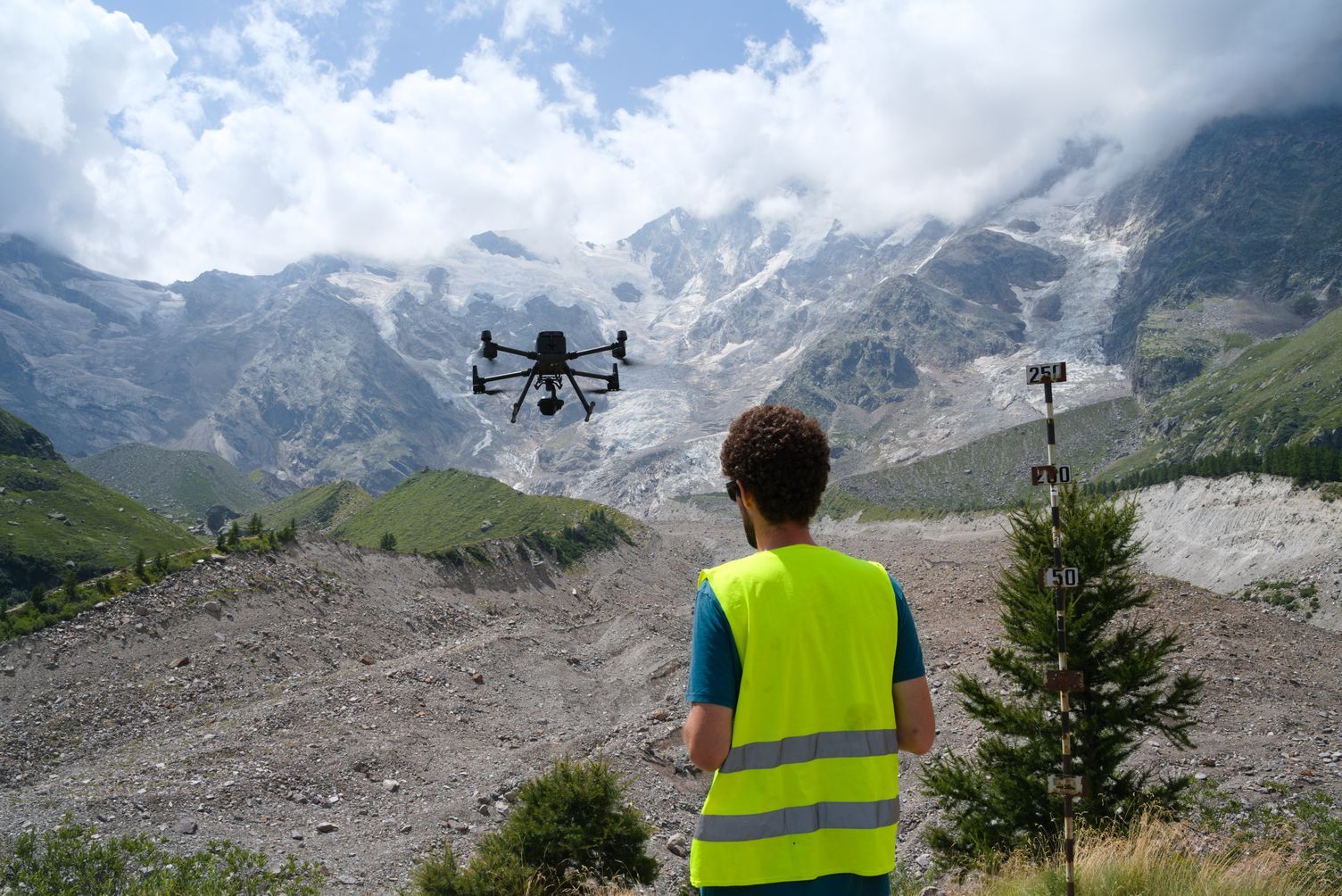
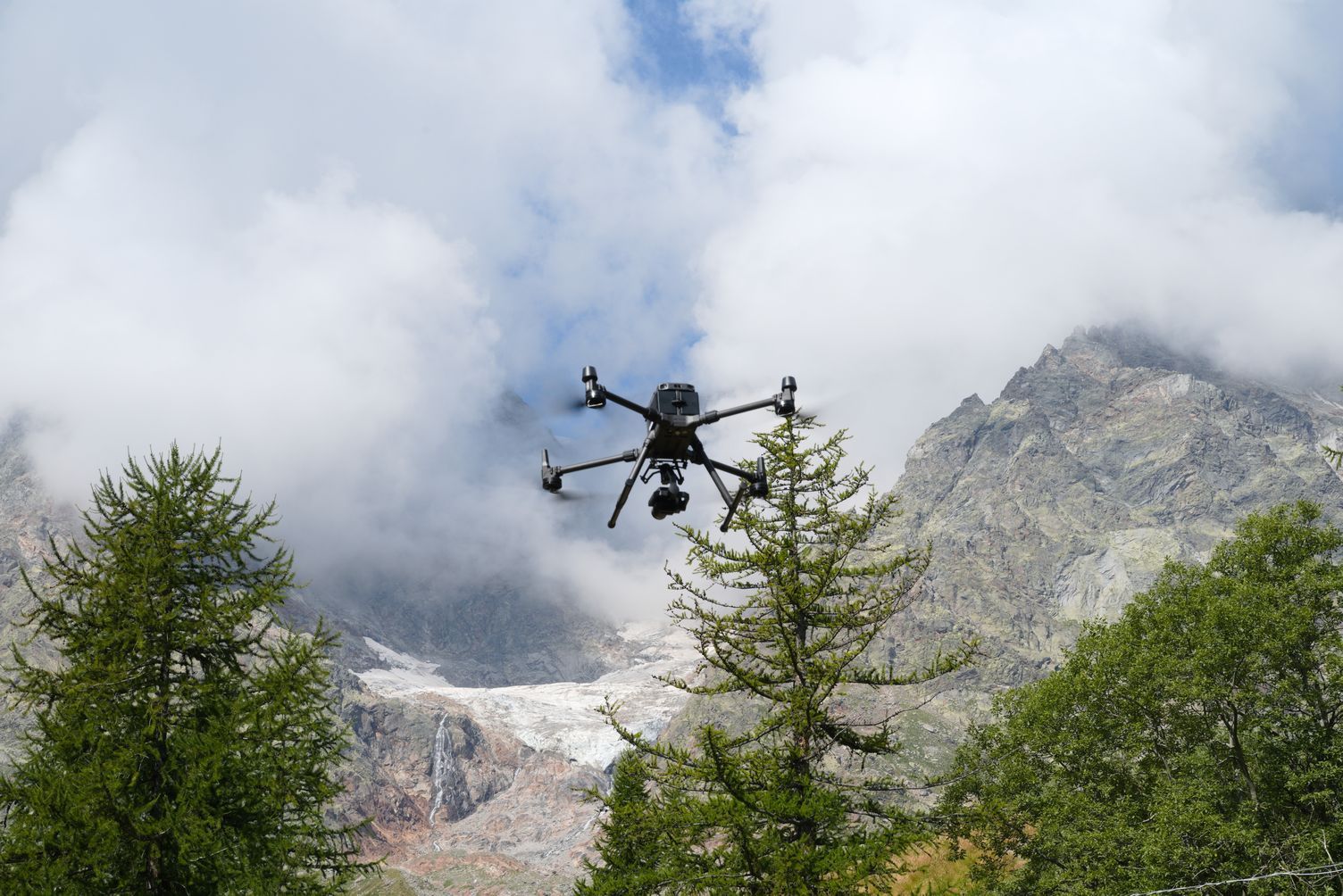
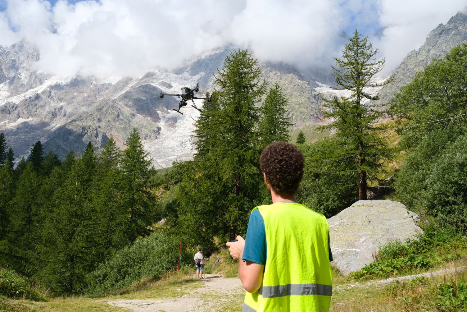
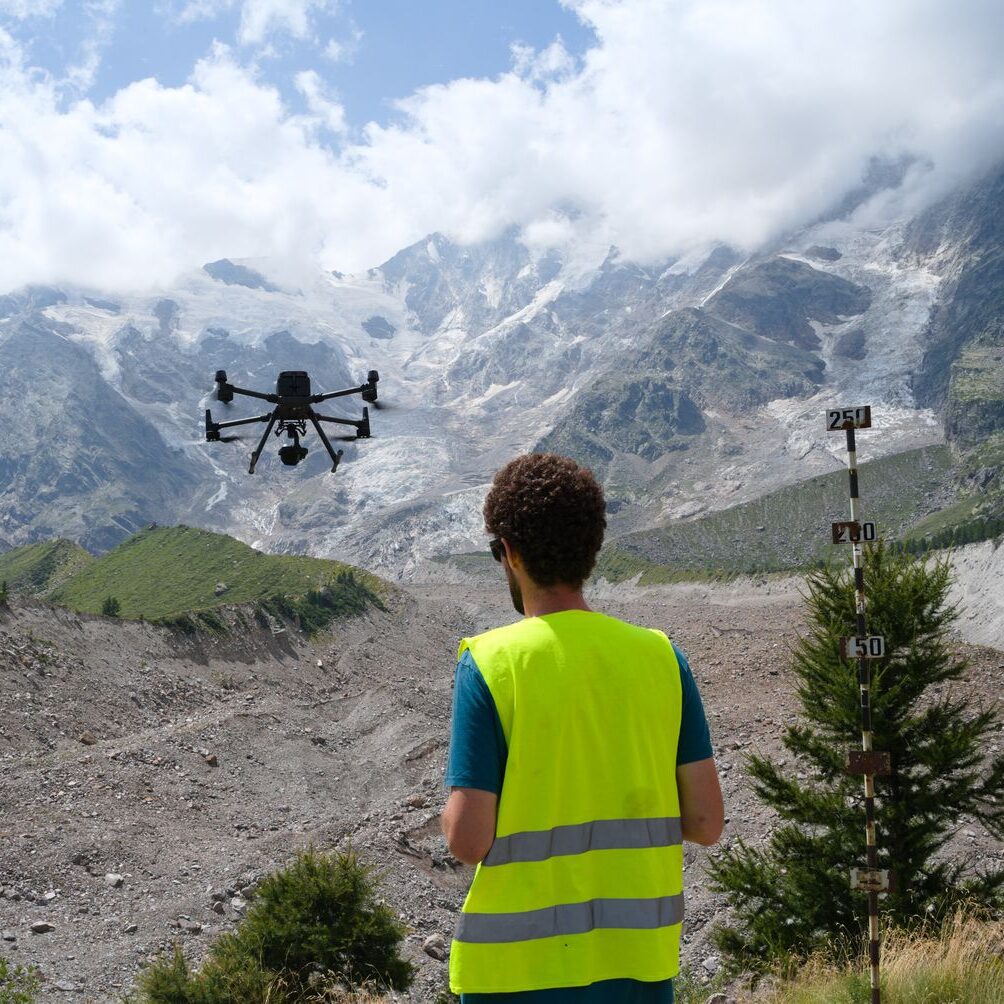
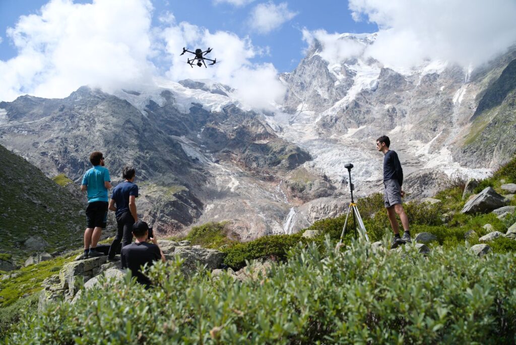
This project aims at a thorough and accurate 4D monitoring of the Belvedere Glacier with photogrammetric approaches, exploiting different spatial (from centimetric to metric) and temporal resolution (from daily to 10-year periods) and with different platforms (UAVs, aerial photogrammetry, terrestrial time-lapse cameras).
Since 2015, an extensive and continuous monitoring activity was carried out with UAVs-based photogrammetry and in-situ GNSS measurements (Ioli et al, 2022). Every year, fixed-wing UAVs and quadcopters were used to remotely sense the glacier and build high-resolution photogrammetric models in order to estimate annual variations of ice volume and ice flow velocities.
The monitoring activity carried out on the Belvedere Glacier was designed and conducted jointly by the Department of Civil and Environmental Engineering (DICA) of Politecnico di Milano and the Department of Environment, Land and Infrastructure Engineering (DIIATI) of Politecnico di Torino. The DREAM projects (DRone tEchnnology for wAter resources and hydrologic hazard Monitoring), involving teachers and students from Alta Scuola Politecnica (ASP) of Politecnico di Torino and Milano, contributed to the campaign from 2015 to 2017.
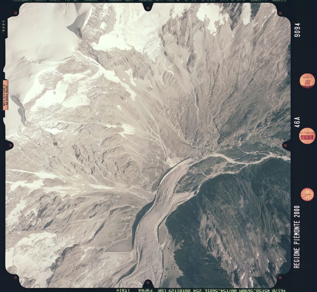
Moreover, to reconstruct the long-term evolution of the glacier, from 1977 up to now, we used historical images acquired for regional mapping purposes. Historic analog images were digitalized and processed with a modern photogrammetric approach to derive the glacier 3D morphology in 1977, 1991 and 2001 (De Gaetani et al., 2021).
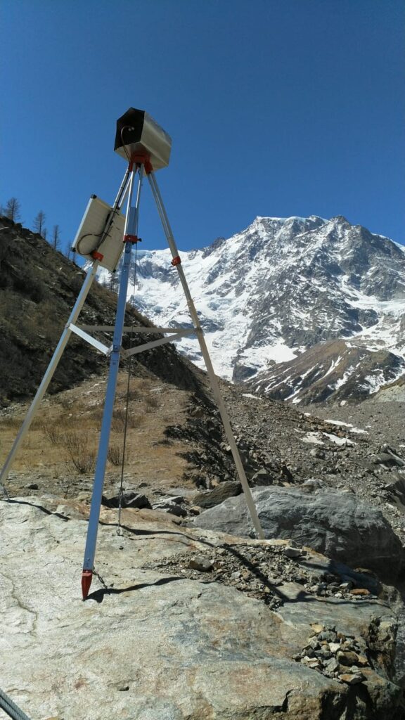
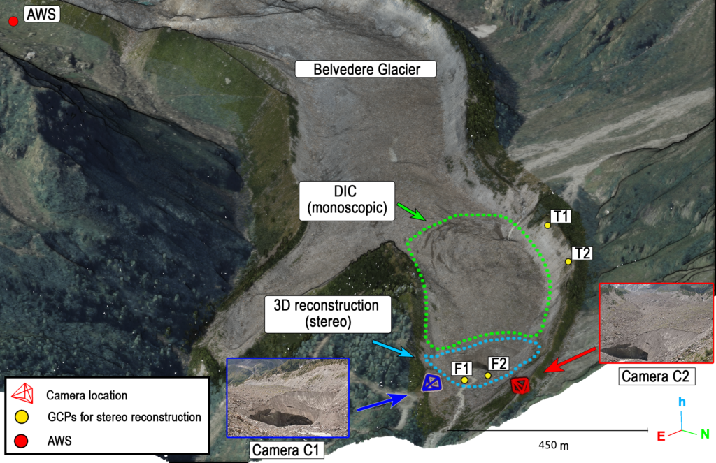
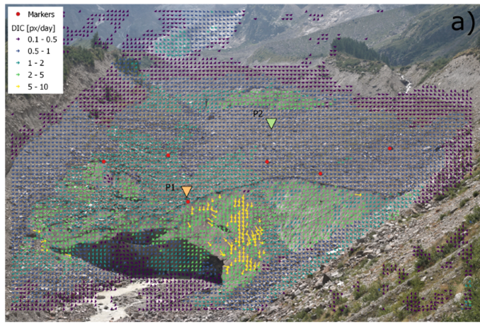
Currently, two time-lapse cameras, permanently installed at the NW glacier terminus, are being used to derive daily 3D glacier movements and changes in the ice structures (such as ice falls and calving events).
Low-cost stereo-photogrammetry and Deep Learning for 4D monitoring of an alpine glacier
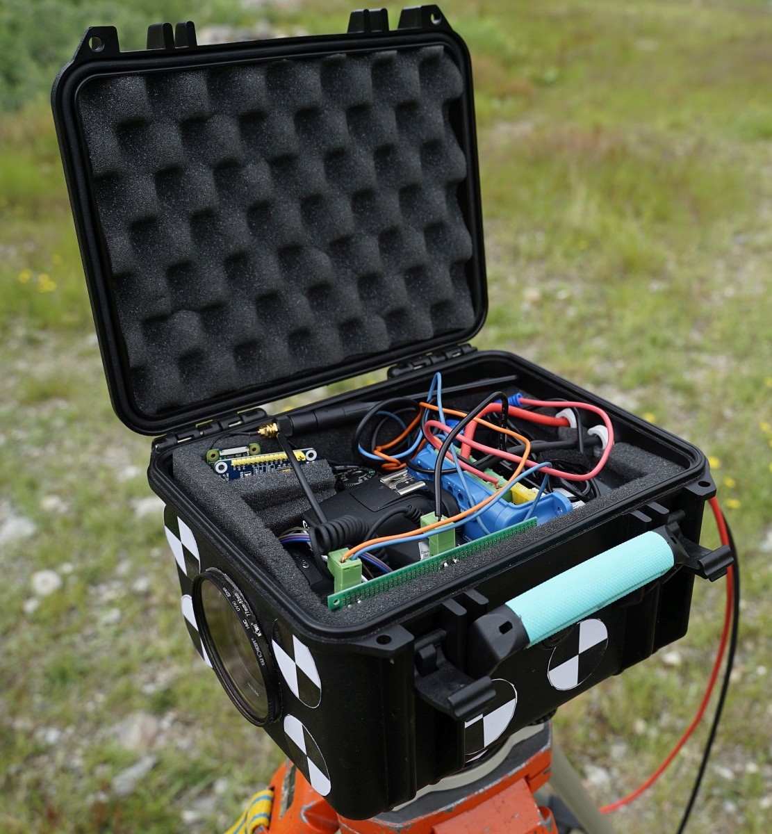
Time-lapse cameras are frequently used to retrieve information on glacial flows. However, only one camera is often employed, preventing photogrammetric reconstructions. To monitor sub-seasonal movements of the glacier, we designed a low-cost stereoscopic system composed of two time-lapse cameras for monitoring the north-west tongue of the Belvedere Glacier.
The stereoscopic system was realized in collaboration with the students of the Kuoleva Jäätikkö project of the Alta Scuola Politecnica (ASP).
Each monitoring station includes a DSLR camera, an Arduino microcontroller for camera triggering, and a Raspberry Pi Zero with a SIM card for sending images to a remote server. The instrumentation is enclosed in waterproof cases. During summer 2021, the two cameras were installed on each side of the Belvedere Glacier terminal ice cliff and they are currently taking daily images.
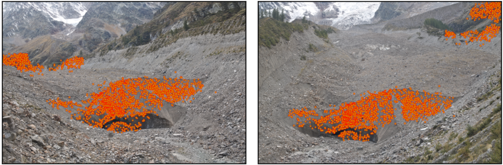
Due to the wide baseline (i.e., ∼260 m), traditional feature-based matching techniques (e.g., the ones implemented in software such as Agisoft Metashape and based on SIFT-like descriptors) fail to find enough homologous points for estimating the orientation of the cameras. State of-the-art deep learning matching methods, such a SuperGlue (Sarlin et al., 2020), outperform traditional feature based matching techniques.
Thefore, it was necessary to develop an ad-hoc pipeline for multi-temporal stereo reconstruction with wide camera baselines: ICEpy4D.
ICEpy4D is a multi-purpose Python package for 4D Image-based Continuos monitoring of glaciers’ Evolution with deep learning SfM and low-cost stereo-cameras and it is available at https://github.com/franioli/icepy4d
The results of the daily monitoring of the Belvedere Glacier using this low-cost time-lapse camera system are published at https://link.springer.com/article/10.1007/s41064-023-00272-w
The Summer School “Design and Implementation of Topographic Surveys for Territorial Monitoring in Mountain Environments“
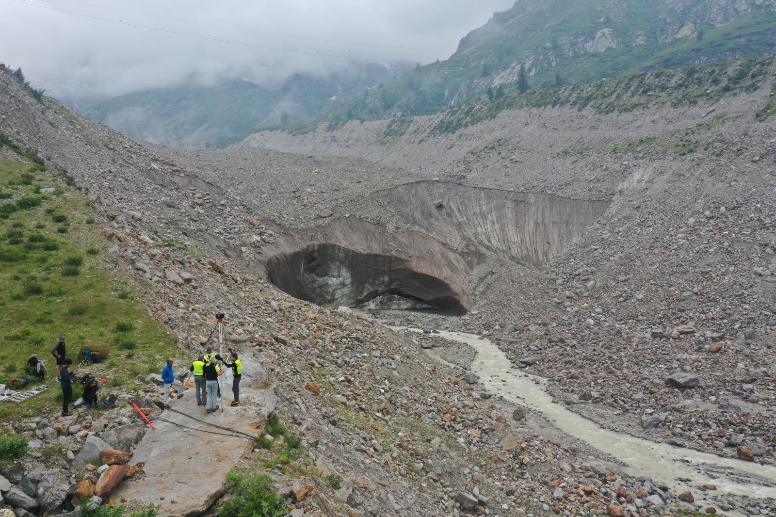
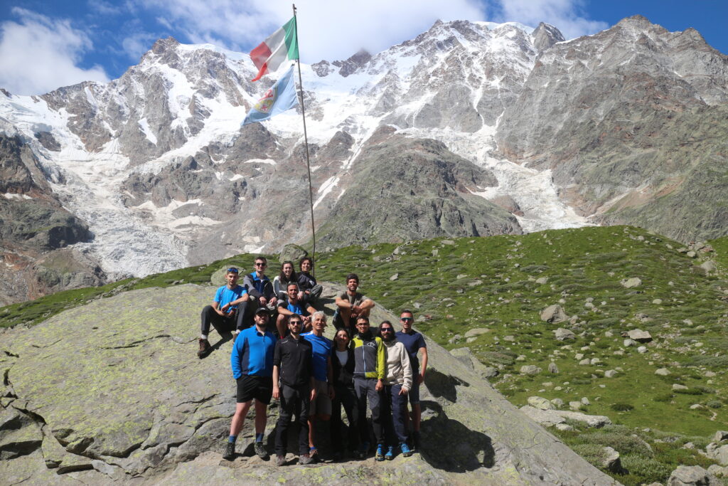
Since 2015, the Section of Geodesy and Geomatics within the Department of Civil and Environmental Engineering is organizing the Summer School “Design and Implementation of Topographic Surveys for Territorial Monitoring in Mountain Environments“. The summer school takes place at the Belvedere Glacier and it is open to undergraduate and graduate students in Civil and Environmental Engineering, Geoinformatics and Architecture.
The main objective of the Summer School is to provide students with practical experience in the field of topographic land monitoring in mountain environments, a crucial topic that is often only taught in theory during classes. In particular, the Summer School focuses on surveying the Belvedere Glacier, a temperate debris-covered alpine glacier, located in the Anzasca Valley, municipality of Macugnaga, Italy, to monitor the glacier’s annual evolution. The 10th edition of the Summer School took place from July 23rd to July 28th 2023.
The teaching material of the summer school is publicly available at https://tars4815.github.io/belvedere-summer-school/ and it was supported by the EGU Higher Education Teaching Material Grant 2023.
On March 4th, 2024, in celebration of OpenDataDay 2024, we have the webinar Mapping Climate Change in 4D: Belvedere Glacier’s Open Geo Data for Education and Research. You can find the slides of the event on Slideshare.
If you want to know more, read our pubblications on the Belvedere Glacier!
Bianchi, E., Gaspari, F., and Migliaccio, F.: An open source WebGIS approach to empower glacier research with scalability and reproducibility, Int. Arch. Photogramm. Remote Sens. Spatial Inf. Sci., 2025, XLVIII-4/W13-2025, 73–78, https://doi.org/10.5194/isprs-archives-XLVIII-4-W13-2025-73-2025
Fajardo Turner, S., Gaspari, F., and Migliaccio, F.: GlacioTools: Streamlining Glacier Feature Monitoring and Reporting in QGIS, Int. Arch. Photogramm. Remote Sens. Spatial Inf. Sci., 2025, XLVIII-G-2025, 439–444, https://doi.org/10.5194/isprs-archives-XLVIII-G-2025-439-2025
Gaspari F, Barbieri F, Fascia R, Ioli F, Pinto L, and Migliaccio F.: Strategies for Glacier Retreat Communication with 3D Geovisualization and Open Data Sharing. ISPRS International Journal of Geo-Information, 2025; 14(2):75. https://doi.org/10.3390/ijgi14020075
Gaspari, F., Ioli, F., Barbieri, F., Bonora, S., Fascia, R., Pinto, L., and Migliaccio, F.: Bridging geomatics theory to real-world applications in alpine surveys through an innovative summer school teaching program, Int. Arch. Photogramm. Remote Sens. Spatial Inf. Sci., 2024, XLVIII-4/W12-2024, 59–66, https://doi.org/10.5194/isprs-archives-XLVIII-4-W12-2024-59-2024
Ioli, F., Dematteis, N., Giordan, D., Nex, F., and Pinto, L. Deep Learning Low-cost Photogrammetry for 4D Short-term Glacier Dynamics Monitoring. PFG – Journal of Photogrammetry, Remote Sensing and Geoinformation Science, 2024. https://doi.org/10.1007/s41064-023-00272-w
Ioli, F., Barbieri, F., Gaspari, F., Nex, F., and Pinto, L.: ICEPY4D: A PYTHON TOOLKIT FOR ADVANCED MULTI-EPOCH GLACIER MONITORING WITH DEEP-LEARNING PHOTOGRAMMETRY, Int. Arch. Photogramm. Remote Sens. Spatial Inf. Sci., 2023, XLVIII-1/W2-2023, 1037–1044, https://doi.org/10.5194/isprs-archives-XLVIII-1-W2-2023-1037-2023
Ioli, F., Bruno, E., Calzolari, D., Galbiati, M., Mannocchi, A., Manzoni, P., Martini, M., Bianchi, A., Cina, A., De Michele, C., and Pinto, L.: A REPLICABLE OPEN-SOURCE MULTI-CAMERA SYSTEM FOR LOW-COST 4D GLACIER MONITORING, Int. Arch. Photogramm. Remote Sens. Spatial Inf. Sci., 2023, XLVIII-M-1-2023, 137–144, https://doi.org/10.5194/isprs-archives-XLVIII-M-1-2023-137-2023
Ioli, F.; Bianchi, A.; Cina, A.; De Michele, C.; Maschio, P.; Passoni, D.; Pinto, L. Mid-Term Monitoring of Glacier’s Variations with UAVs: The Example of the Belvedere Glacier. Remote Sens. 2022, 14, 28. https://doi.org/10.3390/rs14010028
De Gaetani, C.I.; Ioli, F.; Pinto, L. Aerial and UAV Images for Photogrammetric Analysis of Belvedere Glacier Evolution in the Period 1977–2019. Remote Sens. 2021, 13, 3787. https://doi.org/10.3390/rs13183787