A framework like the one outlined by the Italian Guidelines requires a new approach on how to structure and retrieve information on the existing structures. Indeed, a multi-level procedure needs at each level precise and detailed information for both the single structure and its territorial framing, developing a monitoring structure that enables interactions at different scale. For this reasons, less time-consuming methodologies in the field of geomatic needs to be considered, ranging from GIS and remote sensing technologies for context characterization, to photogrammetry and Building Information Modeling (BIM) for structure modelling and analysis.
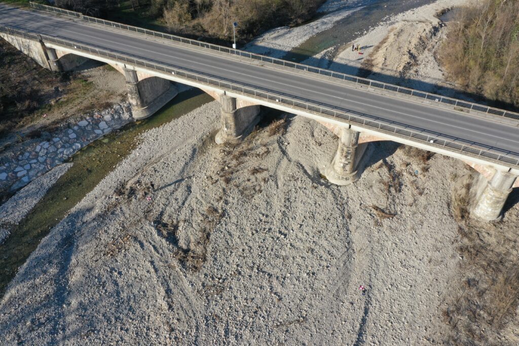
In this context, we perform 3D accurate surveys of civil infrastructures ,such as bridges, viaducts and dams, by using geomatics techniques. These include traditional topographic approaches (i.e., network adjustments with observations from total stations and levelling), high accurate GNSS surveys, Terrestrial Laser Scanners, UAV photogrammetry and UAV Lidar.
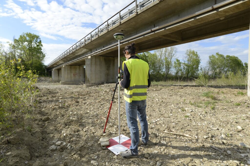
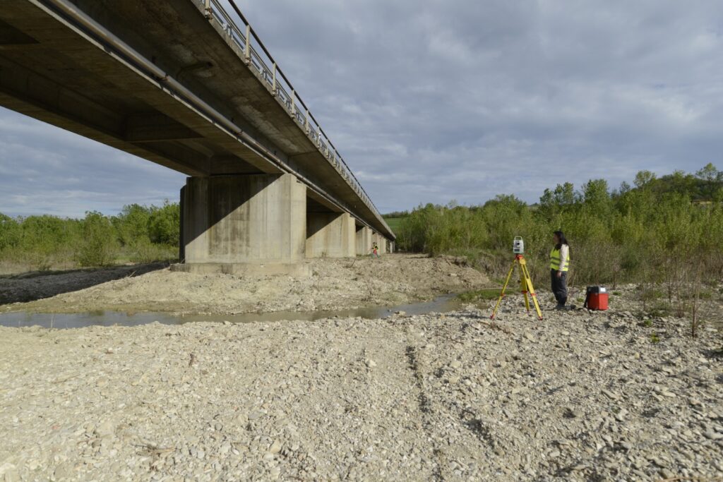
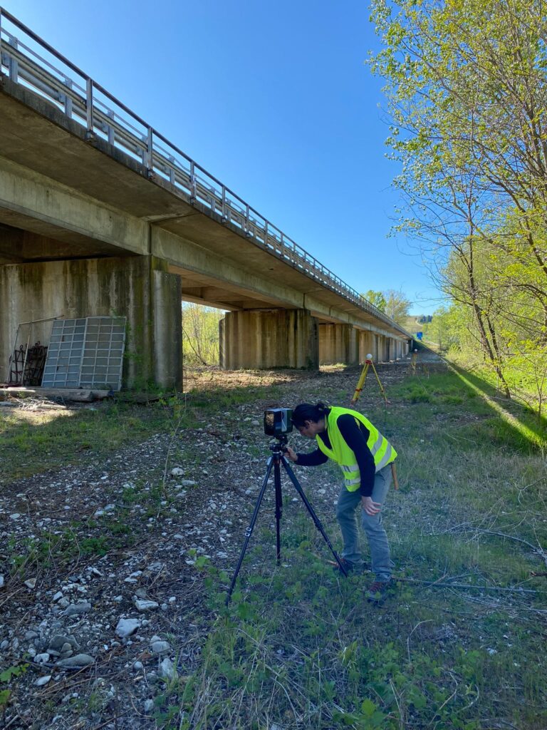
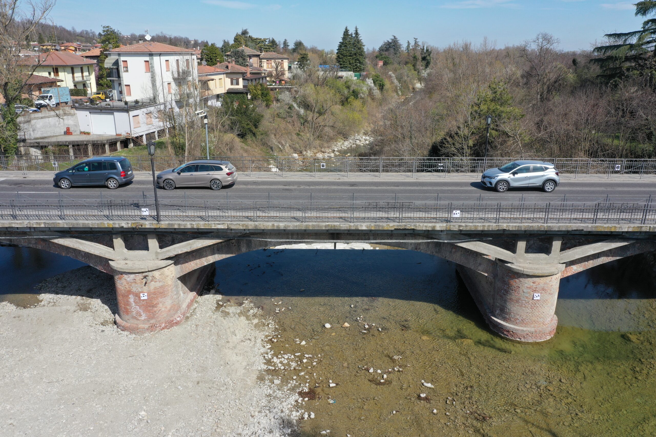
We perform 3D accurate surveys of civil infrastructures ,such as bridges and dams, by using geomatics techniques. These include traditional topographic approaches (total stations and levelling), high accurate GNSS surveys, Terrestrial Laser Scanners, UAV photogrammetry and UAV Lidar.
Below are the infrastructures that have been inspected according to the procedures of the project :
- Ferriere (PC) : February 2022- Potree viewer
- Lugagnano Val D’arda: April 2021- Potree viewer
- Vernasca (PC), Loc. Case Marchesi : 2020- Potree viewer
- Castell’Arquato (PC): April 2021- Potree viewer
- Cortemaggiore (PC): February 2021- Potree viewer
Dams
If you want to know more, read our pubblications on this topic:
Gaspari F, Fascia R, Barbieri F, Roman O, Carrion D, and Pinto L.: A 3D WebGIS Open-Source Prototype for Bridge Inspection Data Management. Geomatics. 2025; 5(4):68. https://doi.org/10.3390/geomatics5040068
Gaspari, F., Briccola, D., Cannata, M., Fascia, R., Carrion, D., and Pinto, L.: Cross‐National Bridge Management Systems: A Geomatics Framework for Italian and Swiss Authorities. ce/papers, 2025, 8(5), 164-171, https://doi.org/10.1002/cepa.3389
Fascia, R., and De Gaetani, C. I. Preliminary BIM‐based solution for bridge data management in the Italian context. ce/papers, 2025 8(5), 178-185.
Fascia, R., Barbieri, F., Gaspari, F., Ioli, F., Pinto, L.: PONTI: An open WebGL-based tool in support to defect analysis and 3D visualisation of bridges, Bridge Maintenance, Safety, Management, Digitalization and Sustainability, 2024, 2353-2361, http://dx.doi.org/10.1201/9781003483755
Gaspari, F., Barbieri, F., Duque, J. P., Fascia, R., Ioli, F., Zani, G., Carrion, D., and Pinto, L.: A geo-database for 3D-aided multi-epoch documentation of bridge inspections, Int. Arch. Photogramm. Remote Sens. Spatial Inf. Sci., 2023, XLVIII-1/W2-2023, 299–306, https://doi.org/10.5194/isprs-archives-XLVIII-1-W2-2023-299-2023
Ioli, F., Pinto, A., and Pinto, L.; UAV PHOTOGRAMMETRY FOR METRIC EVALUATION OF CONCRETE BRIDGE CRACKS, Int. Arch. Photogramm. Remote Sens. Spatial Inf. Sci., 2022, XLIII-B2-2022, 1025–1032, https://doi.org/10.5194/isprs-archives-XLIII-B2-2022-1025-2022
Gaspari, F., Ioli, F., Barbieri, F., Belcore, E., and Pinto, L.; INTEGRATION OF UAV-LIDAR AND UAV-PHOTOGRAMMETRY FOR INFRASTRUCTURE MONITORING AND BRIDGE ASSESSMENT, Int. Arch. Photogramm. Remote Sens. Spatial Inf. Sci., 2022, XLIII-B2-2022, 995–1002, https://doi.org/10.5194/isprs-archives-XLIII-B2-2022-995-2022
Pinto, L., Bianchini, F., Nova, V., and Passoni, D.: LOW-COST UAS PHOTOGRAMMETRY FOR ROAD INFRASTRUCTURES’ INSPECTION, Int. Arch. Photogramm. Remote Sens. Spatial Inf. Sci., 2020, XLIII-B2-2020, 1145–1150, https://doi.org/10.5194/isprs-archives-XLIII-B2-2020-1145-2020.